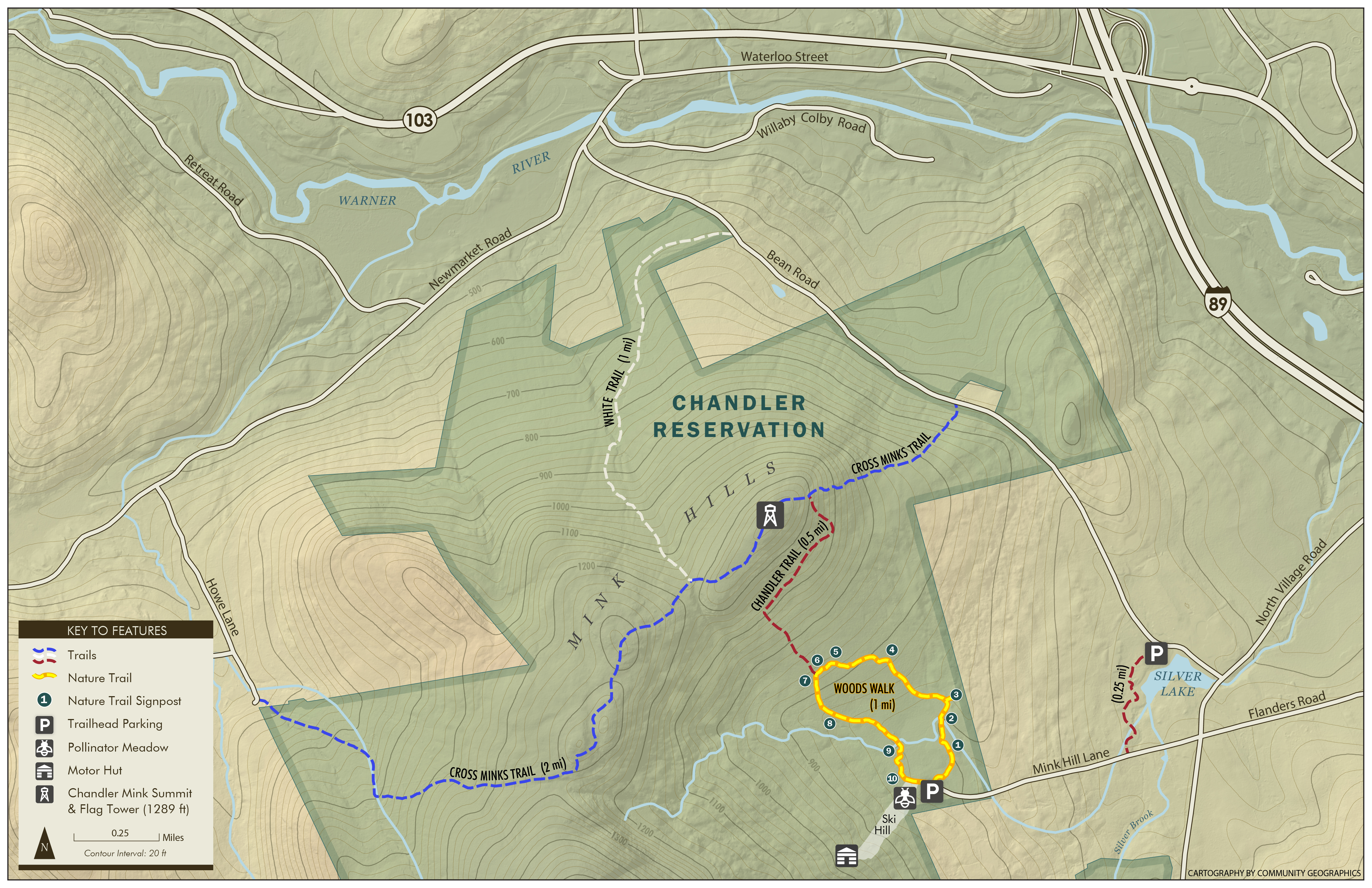
Chandler Reservation Woods Walk
The Woods Walk is comprised of 10 stations on a one mile loop in the Chandler Reservation. Each station has a unique QR code that links to an informational page.The Walk:
- Station 1: Logging Landscape
- Station 2: Woodland Waters
- Station 3: Giant Rocks
- Station 4: Red Oak
- Station 5: Stone Walls
- Station 6: Wildlife Habitat
- Station 7: White Pine And Hemlock
- Station 8: Forest Pests
- Station 9: Sugar Maples
- Station 10: Living On The Edge
Maps:
Shown below is a map to guide you to the trailhead parking. There is a map available at the Select Board's or Town Clerk's offices showing all of the trails on the Chandler Reservation. A downloadable copy of that map is available by clicking here. Also, a full scale 1"=800' topographic map showing the boundaries of the Chandler Reservation is available at those offices.